 |
| Gateway to the West |
In honor of the end of tax season (I am a tax accountant by trade), my wife and I made a trip to St. Louis last weekend. Why St. Louis? My wife had never been and wanted to see the Arch and a couple of museums, and the Gateway to the West is usually a most pleasant place to be in late April. This would be a short trip (10 P.M. Friday to 8 P.M. Sunday), but having been to the city several times over the past few years thanks to an ex-client located here, I know my way around and figured this would be enough time for what we wanted to see.
Our Day 1 itinerary (covered here):
The Gateway Arch and surrounding grounds
Pappy's Smokehouse
Route 66 from St. Louis to Litchfield, Illinois
Edward "Ted" and Pat Jones Confluence Point State Park (confluence of Missouri and Mississippi Rivers)
Zia's on the Hill
Our Day 2 itinerary (covered in Part 2):
The Old Courthouse Museum
Missouri History Museum
Forest Park
The Great River Road from Alton to Nutwood, Illinois
I won't write up a detailed flight review, but did want to briefly talk about our flight up to St. Louis on Southwest. Southwest has been hyping the rollout of their new-and-improved WiFi system on board which includes free Dish TV (they charge for WiFi, but you can access Southwest.com, a flight tracker, and Dish TV without paying). I seem to always draw the short straw when flying Southwest, getting old planes with no WiFi on probably 2/3 of my trips. This time, though, our plane had it, and I got to try it out. It is pretty awesome - both the TV and the flight tracker.
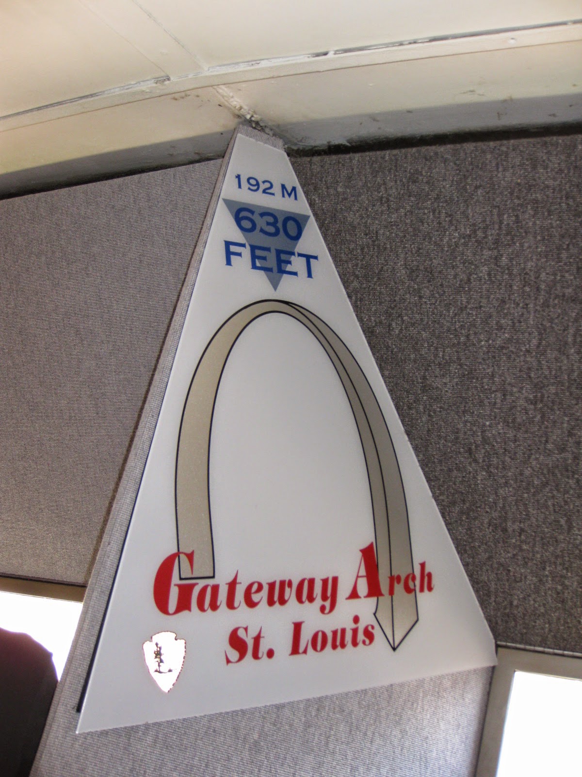
We didn't get in until a little before 10 Friday night, so we wouldn't start touring until the next day. Before we left on Friday, the forecast called for great weather on Saturday but the possibility of rain on Sunday, so we made plans to do most of our outdoor-related stuff on Saturday. First up - the most recognizable symbol of St. Louis, the
Gateway Arch. I will post a more detailed write-up of the Arch and the larger
Jefferson National Expansion Memorial later, but will include a brief summary here.
Instead of the usual approach to the Arch from downtown, we approached from the opposite end, along the riverfront. From this side, you truly experience the "Gateway to the West".
The lawn on the east side of the Arch also affords a fine if distant view of the old federal courthouse, now the
Old Courthouse Museum, which I will also cover in more detail in a future Arch-related post.
There are a variety of things to do inside the Arch, including The Museum of Westward Expansion, tram rides to the top, and a couple of IMAX-like movies. We did all three, and started off with the museum, which has several exhibits and artifacts covering the first Lewis & Clark expedition, and the country's subsequent expansion west of the Mississippi River in general.
 |
| Tribute to Eero Saarinen, who designed the Arch. |
 |
| Red Cloud, a chief of the Lakota Sioux tribe |
 |
| Conestoga wagon typical of the 19th century | | | | | | |
|
|
We watched a movie about the Lewis & Clark expedition, then took a tram up to the top to take in the view. Visibility is 30 miles on a clear day, with an especially good view of the old courthouse and Busch Stadium, home of the St. Louis Cardinals.
We were originally planning to visit the Old Courthouse Museum immediately afterwards, but it was already pushing 1:30, and our plan for the remainder of the afternoon required a rather long drive from downtown. So, we just walked around the grounds of the Arch and the Old Courthouse before heading to lunch. As an added bonus, it was a picture perfect spring day with the trees just beginning to bloom.
 |
| Trees in bloom with the Arch looming behind |
 |
| Old Courthouse gardens |
 |
| Old Courthouse viewed from the west |
 |
| The large park to the north of the Arch |
After lunch at
Pappy's Smokehouse (full review coming later), we hit the Mother Road for as much of
Route 66 as we could get in before our final stop for the day. Much of Route 66 in Missouri and Illinois is still accessible and driveable, making St. Louis a good starting point for road geeks. We made it as far as Litchfield, Illinois, 53 miles to the north, before having to turn around. CAUTION: although many parts of St. Louis have been cleaned up and restored, several parts of the city, along with East St. Louis and Madison Illinois across the river, are in rough shape. REALLY rough shape, arguably equal to what you'd find on the south side of Chicago or in Detroit. This includes several neighborhoods where Route 66 passes through today. If you're going to explore Route 66 in the area, make sure you know where you're going.
We stopped for a while at the
Chain of Rocks Bridge, a bridge across the Mississippi River that actually carried a bypass spur of Route 66 around central St. Louis. The bridge is now closed to vehicular traffic, but you can still hike or bike across it. The bridge is famous for the curve built in halfway across the bridge.
 |
| East end of the bridge on the Illinois side |
 |
| Bridge deck heading west |
 |
| Looking south |
 |
| Pair of old road signs at the Illinois/Missouri state line |
 |
| The curve |
 |
| Old pump station with St. Louis skyline in background |
 |
| Original concrete pavement on bridge access road |
From here, we continued up to Litchfield. We didn't have a ton of time to search for old Route 66 architecture (think Art Deco), but did spot a couple of restored touristy-spots along the way. One other note for road geeks - after you cross I-55 north of Staunton, you will see several sections of fairly well-preserved abandoned road to your right. Much of Route 66 between St. Louis and Chicago was expanded to a divided highway after World War II, but with the construction of parallel Interstate 55 later, the divided highway became unnecessary, and the state gradually abandoned one set of lanes. You can still walk or bike across some sections, though most bridges and culverts have been removed.
 |
| The quiet town of Edwardsville, Illinois |
 |
| Restored business in Hamel, Illinois |
 |
| Restored gas station in Staunton, Illinois |
 |
| Abandoned section of divided highway approaching Litchfield |
At this point, we turned around and used the quicker I-55 to head back towards St. Louis for our last to-do list item of the day - the
Edward "Ted" and Pat Jones Confluence Point State Park just across the river from Alton, Illinois, where the Missouri and Mississippi Rivers come together at a single point. We barely made it in time, just as the sun was setting. From the small parking lot, a 1/4 mile trail leads to a single point where America's two great rivers, the Mississippi and Missouri, come together, and then flow downstream to the Gulf of Mexico as one. The park is inaccessible when the rivers are in flood.
 |
| Access road to the state park |
 |
| Missouri River approaching the confluence point |
 |
| The confluence point, marked by the monument at the end of this walkway |
 |
| Mississippi River, looking upstream towards Alton, Illinois |
 |
| Closer view of confluence point |
 |
| 1993 flood marker |
 |
| Fiery sunset over Missouri River |
To cap off a wonderful day, we then went to
Zia's on the Hill, a well-regarded Italian restaurant in The Hill neighborhood, St. Louis' version of Little Italy. I'll post a full review on Zia's later. The Hill is a picturesque Midwestern neighborhood, but as it was completely dark by the time we got there, I couldn't take any photos.
And with that, just about a full 24 hours after first arriving at our hotel, we came back and crashed after a long day. Read about Day 2 of our visit in my next post.


No comments:
Post a Comment