 | |||
| Scenic overlook with winding highway in background |
What Is It
The Talimena National Scenic Byway, sometimes called the Queen Talimena Scenic Byway, stretches 54 miles through the Ouachita Mountains (the southernmost portion of the Ozarks), from US 271 north of Talihina, Oklahoma to US 59/71 in Mena, Arkansas. It is marked as State Highway 1 in Oklahoma, and State Highway 88 in Arkansas. The Byway is a miniature version of the Blue Ridge Parkway/Skyline Driving stretching through North Carolina and Virginia. It was completed in 1969, but had its origins in two truck trails constructed by the Civilian Conservation Corps (CCC) during the Great Depression. Several scenic overlooks and campgrounds along the road were built by the CCC, as roadside markers indicate.
How to Get There
The most direct route to get to the Byway from Dallas is to go north on US Highway 75, go east on State Highway 43 in Stringtown, Oklahoma, then north on State Highway 2 on the south side of Sardis Lake, then east on State Highway 1 to Talihina, and finally north on US Highway 271 about 8 miles to Talimena State Park and the state of the parkway. Total driving time is approximately 3 hours and 30 minutes from downtown Dallas. You can also start at the eastern end of the Byway by taking IH-30 east to Texarkana, then north on US 71 to Mena, Arkansas. Driving time is approximately 4 hours and 15 minutes.
For best results, allow approximately 3 hours to drive the entire Byway, so as to allow time to enjoy all of the scenic overlooks, do some hiking, and perhaps enjoy a picnic lunch at either Talimena State Park or one of the many picnic tables along the road. If you don't have time to do the entire thing, you can do what we did, and leave the road at US Highway 259 (about 90 minutes from the road's start), head south to Idabel, then head west then south on State Highway 37 back across the Red River to Mt. Vernon, Texas. Here, you can catch IH-30 west back to Dallas. The return trip home via this route is approximately 4 hours. This makes for a total travel time of approximately 11 hours if you do the full length of the Talimena, or approximately 9 hours if you do only the first half to Highway 259.
Most of the trip to and from the Byway is an easy drive, with some nice scenery past Stringtown in Oklahoma, down US 259 to Idabel, and on US 59/71 between Mena and Ashdown. Driving conditions can be challenging going up Winding Stair Mountain on US 271 past Talihina, along the Byway itself, and going through the other side of Winding Stair on US 259 a few miles past the Byway junction, due to steep grades and sharp curves. Similar to the Blue Ridge Parkway, the Byway is built atop the ridges that make up Winding Stair Mountain, and as such, the road dips, climbs, and curves along the natural contours of the mountains. There are a few especially steep grades, where a lower gear is necessary to head down, even in a small passenger car. Travel is not recommended during foggy or icy weather; you won't be able to see anything during fog, anyway, and the Byway is usually closed during snow or ice since the area isn't equipped to deal with clearing snow.
What to See
I called this a "miniature" version of the Blue Ridge Parkway, not just because it's shorter, but also because the mountains top out at a much lower elevation (about 2,000 feet at the highest point of the Talimena, compared to slightly over 6,000 on the Blue Ridge). The scenery, however, is similarly spectacular. Before I get to that, though, they say half the fun of seeing someplace is getting there, and there is some nice mountain scenery on the way there. Your first views of the Ouchitas come up quickly as you drive east on State Highway 43 past Stringtown.


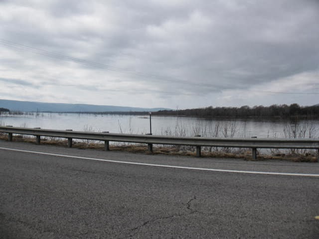
 Later, as you approach State Highway 2, you catch a glimpse of Sardis Lake. The highway actually runs right over the dam, and there is one parking area (which we missed seeing, unfortunately) that provides a sweeping view of the lake. Most of the other pull-out areas along the lake require the payment of a fee to enter, however. I did manage to get one photo looking back to the south as we passed the lake.


A few miles further down, Sugarloaf Vista provides a view of Sugarloaf Mountain in the far distance (the high mountain in the middle of the distant ridge in the first picture). The mountain was historically used as a landmark for travelers going on foot or horseback to or from Fort Smith, Arkansas to the north. In the second, the shadows from the clouds in the late afternoon sun make for a somewhat haunting scene.


When to Go
The best time to go is during fall foliage season, which generally peaks in early-to-mid November. Although not as well known as other fall foliage displays around the country, such as the Blue Ridge or Vermont, the color can be quite spectacular here in the Oklahoma mountains, with bright reds and golds predominant during good years.
The weather follows roughly the same season that you find in East Texas - hot and humid from late May through mid-September, pleasant but occasionally stormy from mid-March through mid-May and mid-September through mid-November, and cool and wet with occasional sharp cold spells from mid-November through February. Be advised that although the elevation in the Ouchitas isn't that high, with the highest peaks only a little over 2,000 feet, temperatures along the ridgeline of the Byway can be up to 10 degrees cooler than in the valleys below. Be especially aware of this during winter, when a cool day in Dallas can be a cold one here.
Serving Suggestion
As mentioned earlier, if you leave Dallas in the morning, Talimena State Park in Oklahoma, or one of the many picnic tables along the Talimena itself (particularly the Horse Thief Springs turnout area), makes for a perfect place for a picnic lunch, particularly on a warm day. If you have more time, make it a long weekend, and instead of turning south back towards Texarkana in Mena, head north, then east on US 270 to Hot Springs National Park in the appropriately named Hot Springs, Arkansas.
You can also head over to Crater of Diamonds State Park in Murfreesboro, Arkansas to try your like at digging for diamonds (yes, you are allowed to keep anything you find). From Mena, head south on US 59/71 to Wickes, then east on US 278 to Nashville, then north on State Highway 27 to Murfreesboro. I wouldn't advise trying to do both the scenic drive and the Crater of Diamonds in the same day, though. You likely won't make it in time, and digging for diamonds does make for quite the workout, especially when it's hot outside.
No comments:
Post a Comment