Cahal Pech
Open: 8-5 all yearFees: BZD 10/USD 5 per person. National Institute of Culture and History personnel will offer you a guided tour of the site for USD 20.
Location: on the western end of San Ignacio. Heading west, you will see the sign for Cahal Pech next to a gas station. Turn left at the sign, and then immediately turn right on the road going up the hill. You will see the visitor center at the top of the hill.
Official website: http://nichbelize.org/ia-maya-sites/cahal-pech.html. Click on "Archaeology of Cahal Pech" for detailed information. A map of the site can be found here.
Time needed: minimum 30 minutes; 60-90 minutes for the optimal experience. You can combine a trip to Xunantunich if you have a full day to explore the area.
Special notes: climbing the ruins is permitted, but the steps can be slick during and after rains. Wear proper walking shoes. Also carry water, as climbing the ruins in the tropical heat can be difficult.
Cahal Pech literally means "place of ticks", but don't worry, you don't have to worry about being bitten today. The site was believed to have been settled around 1200 B.C. and abandoned around 900 A.D., and was home to a population of 10,000-15,000 people at one point. It consists of seven plazas (dubbed A through G), two ballcourts, and several temples and tombs. A visitor center with a small Mayan archaeological/cultural museum has been constructed at the entrance to the site, where you can buy your tickets, hire a guide if desired, and learn some basic information about the Mayan civilization that lived at the site at the museum. Once you're ready, walk across a bridge behind the visitor center, which opens up into Plaza "B". Reportedly, the site's inhabitants would have congregated in this plaza for important events, such as festivals or market days.
To the right, on the western end of Plaza B, is a royal residence.
A look at Plaza B, followed by Plaza E, from the top of one of structure A-2 on the west side.
The smaller Plaza A, accessed by climbing the structure (A-2) at the west end of Plaza B. The A-2 structure was an administrative building/royal residence, so this plaza was likely used by the ruling elite for functions. Important visitors would have been greeted in A-2.
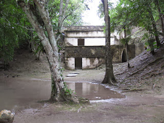
Plaza D, on the far west end of the site. This plaza was partially water-logged thanks to heavy rains the last few days. An obstructed view of the jungle can be seen from the outer wall; this is a good spot for bird watching.
This is the large "B-1" structure on the east end of Plaza B.
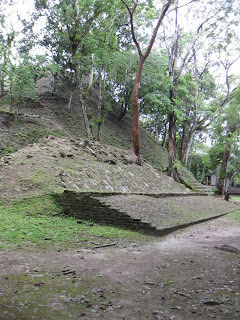
I believe this is a pathway between Plazas F and G, with a badly deteriorated structure in the second photo.
A pathway leading to Plaza C. This path wasn't marked, but looked to be the main entrance to the settlement at one time.
And finally, from the top of the large "B-1" structure, a couple of panoramic views of the large Plaza B, and the administration building in the background of the second picture.
I saw Cahal Pech referred to as a "starter Mayan site" on another Belize travel website, and I think that's a pretty apt description. It isn't as interesting as Altun Ha, and from what I've heard, not as good as Xunantunich either, but it's still worth stopping by. The main issue with Cahal Pech is its location, way out on the western end of the country, making it a long drive from Belize City (2-2 1/2 hours) or from the resorts of Hopkins and Placencia (2 1/2-3 hours from Hopkins, add another 30 minutes from Placencia). I don't know that I'd go all that way just to see Cahal Pech, but it is an ideal add-on if you're in the neighborhood to see something else, or if you're staying in the nearby Mountain Pine Ridge for a few days.


No comments:
Post a Comment